Tuesday 22 August 2023

RAW and Photoshop to the rescue - it was a tornado...!

Sorting through all the photos after a chasecation takes some time, choosing the best shots, processing the RAW files, putting them in order, creating an album, making some prints and so on...it's rewarding, takes you back to the moment...but it takes time.

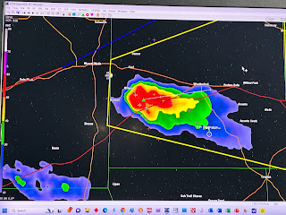
So on Day 1 I thought I could make out a pale white, low contrast tornado several miles distant but not conclusively. See the Day 1 blog entry. I put the 100-400mm Sigma onto the Nikon Z7, pointed it at the target and fired off a couple of frames at 400mm. Now the key to taking photos of storms is to step back from the literal maelstrom and calmly keep on top of your photography discipline so that you get optimal results, the best combination of focal length, aperture, shutter speed, ISO with appropriate variations to get the best exposure. And keep checking your settings to make sure you don't wander into the sub-optimal, and of course, always shoot in RAW so that you can reprocess the shot and eek out every last bit of quality from the full data set captured by the camera.

This particular shot was overexposed by one stop along the principal of "Expose To The Right" (ETTR) which pushes the highlights but not to the point that they blow out which in turn lifts the shadows so optimising the data in the RAW file. The JPEG straight out of camera was, to be honest somewhat underwhelming and gave no indication of a tornado.

The RAW file was worked on with some brutality in Adobe Camera RAW in Photoshop. It won't win any prizes for artistic or technical merit but shows, without doubt, the presence of a tornado. Worth the time and effort for sure and shows the merit of shot discipline when the adrenaline is up. And my eyes were not deceiving me at the time. 


Monday 12 June 2023

Epilogue…

So here we are sat in the Wyndham Gardens in Oklahoma City and it’s pouring down, with thunder and lightning. Our trip to Bricktown now won’t be happening, in the unlikely event it clears up we might make it to Whataburger. Oh the irony. 


I managed to sort out the roaming issue and my ankles are less swollen though still look fairly angry. 


A good trip and around 900 fewer miles than you’d expect as the furthest north we went was Trinidad, Colorado which is completely at odds with last year’s trip where we ended up in Montana and North Dakota. 


We were unlucky not to see a tornado on day 1 as  the storm hugged the road and we could not get in front of it. We’ve seen plenty of weather, done cool stuff, eaten well and even managed a couple of beers. Might even have come in under budget. The main thing is that Rory really enjoyed it.  


A quick summary:


0 - Oklahoma City - Childress, Tx - 208

1 - Childress, Tx - Sonora Tx -639

2 - Sonora Tx - San Angelo Tx - 256

3 - San Angelo Tx - Amarillo Tx - 379

4 - Amarillo Tx - Trinidad Co - 267

5 - Trinidad Co - Albuquerque NM -  382

6 - Albuquerque NM - Sonora - 610

7 - Sonora Tx - Lubbock Tx - 341

8 - Lubbock Tx - Perryton Tx - 544

9 - Perryton Tx - Cleburne Tx - 525

10 - Cleburne Tx - Oklahoma City - 467


Total miles: 4,618 


Grand total: 36,867


Sunday 11 June 2023

Day 10 - 100f and counting...

On checking out of the hotel this morning one thing was apparent: it was HOT.

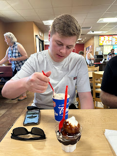
We make our way over to the Our Place Family Restaurant for a good breakfast and with plenty of time to kill so travel to Dinosaur Valley State Park near Glen Rose. The Paluxy River flows through the park and under the water are well preserved dinosaur footprints which are very cool. What is not cool is the weather, the extreme heat forces us back into the oasis of air conditioning in the Suburban. We have one more stop then exit the park as the heat is just too much, passing by the Creation Evidence Museum..I kid you not...so it's off to the DQ for ice cream. I have a chocolate sundae, Rory a Blizzard Pecan Cluster. 

There's still a pile of time to kill before there's any weather to consider so we head back east on the US67 through Alvarado with Waxahachie in our sights. The mercury passes through 100f and the prospect of doing any kind of outside tourist stuff has disappeared with the heat.

As for the weather, the SPC has upgraded the forecast to an enhanced risk, with a slight risk in our area. Bearing in mind today is our last chase day, the enhanced risk is much further east and is out of reach; we need to be back in Oklahoma City tonight so we'll play with the slight risk. We'll have a punt on McKinney which is north east of Dallas and will see what happens. Just before 16:00 we get to Waxahachie and stop at Stuckey's, another cultural reference from a Dead Kennedys song (Winnebego Warrior). The chain is a shadow of its former self; I've never been to one before, so itch scratched. It's still stupidly hot...Rory insists we get some beef sticks but we decide against getting a bumper sticker...We enter Dallas...and a change of plan, heading west on I30 as a mesoscale discussion has been issued by the SPC with the potential for a severe weather watch. We pass the Ripley's Believe it or Not museum...

We pass through Fort Worth and sure enough at around 16:45 a severe thunderstorm watch is issued, and shortly after a cell pops up to our west.

We stop at Weatherford for the team photo, and while that is getting sorted out a cell explodes to our south west. Cripes...game on! We dart south on Highway 171 then on to Granbury Highway, Texas 51 south to Fairview, stopping at various points for photos, trying to keep ahead of the rain and hail then moving on. This now severe warned storm is spectacular and is all around us, even the 15mm full frame lens on the Z7 barely makes a dent in it, the 13mm equivalent lens on the iPhone is not much better; this thing is huge. There's CG lightning, a billowing updraft, two and a quarter inch hail in the core and it has topped out at 59,000 feet. There's also a rain foot as the outflow blasts rain outward in a huge gust. Spectacular!

We then do an about turn and head back north, retracing our steps. We need to punch through the core, now weakened to get back to Weatherford; the rain is torrential with the characteristic twang of hail on the roof. We get on the other side and head north through Weatherford, which is a nice, quaint town with square and courthouse. Just north of town there are police lights and a really nasty road traffic collision between two vehicles. It's now 20:00 and Google maps says it's 188 miles and 2.50 hours to our base hotel in Oklahoma City.

What a spectacular end to the tour, a final day promising little other than a punt on the way back to our base hotel. Hopefully the bar will still be open when we get back. It isn't. And to add insult to injury EE decided to cut of both our roaming packages at 21:30 tonight despite telling the idiots we land back in the UK on Tuesday which is two days away. And they don't open until the morning, so that's to be sorted out tomorrow.

Last thing...after a 14+ hour day...we have both been bitten death by various bugs, Rory has about 15 bites, I have 8 and both my ankles have swollen up.

Total miles: tbc


Saturday 10 June 2023

Day 9 - The Lone Star chase...

We're on the road at 07:00 with a target area of Mineral Wells which is west of Dallas, a 6 hour drive away. Breakfast is on the run from...McDonalds...which get's forced down. We head south on US83, have a pitstop at Wheeler then onto Shamrock for a wander around the historic U Drop Inn Cafe, the restored Art Deco gas station on the old Route 66. 

The SPC has upgraded the tornado risk to 5%, presumably they were waiting for the location of the outflow boundary from yesterday's storms. We continue south on US83.

The long journey continues, south to Childress, east to Quanah then south to Seymour and a stop at the Chicken Express; nice fries but the chicken was mostly batter and the 32oz Diet Coke was just intimidating. We take a further pit stop at Breckenridge then east to Gordon and south on Highway 108. The topography changes and we are surrounded by pretty woodland.The SPC has upgraded its mesoscale discussion to a severe thunderstorm watch.

We head through Stephenson, stock up on some van snacks then a couple of stops to view a decent updraft including at Hico then head east with the outflow boundary clearly visible on radar.

We continue past Lake Whitney then stop at Hillsboro. The cells where we are don't look too promising and a severe warned storm has blown up to out north west, so change of plan and we're off north on Highway 171 to intercept.

We find a vantage point on the crest of a hill on US67 between Nemo and Cleburne and there in front of us is a the only severe warned storm in our area with a nicely defined wall cloud. After the mammoth drive today it felt like the storms gods were playing with us - finally a break. We stopped here for a while, the storm gently tightening up into an amazing structure, a boundary passed over us and the air became sticky, the storm going east and the boundary going west collided giving extra impetus. Finally it started raining so time to call it a day not before Reed Timmer in one of the Dominators had wizzed past.

We went to for dinner at Pastafina, an Italian restaurant in Cleburne. The pizza sizes were translated into actual sizes by the nice young waitress: Personal, small, medium and large. I optimistically go for the small, Rory despite my best advice goes for a medium, and of course when it turns up it is...ENORMOUS. He manages half of it, the rest for some point in the future.

When we leave the restaurant the skies are an amazing sight, almost like an impressionist painting and when we arrive at our hotel for the night, La Quinta at Cleburne, the sky is now under lit by the setting sun eventually checking out in an amazing shade of pink.

Total miles: